
Location determination is widely used in mobile apps and incredibly popular around the world. According to the Allied Market Research forecast, the location-based services market will reach $157.34 billion, from 2019 to 2026, with a growth of 27.1% per year. These technologies offer great benefits and open advanced marketing tactics for businesses. Just imagine – you can see where your customers are located and offer a service or product exactly when they need it.
Geolocation applications significantly transformed the dynamics of interaction between brands and consumers. We can see its capacity in real-life examples: Foursquare gained a loyal audience of 60 million users when they allowed restaurants to register on their platform. Uber reached a market value of $72 billion by connecting passengers and taxi drivers. Starbucks increased sales by adding local notifications. You may also remember the lightning success of Instagram and Pokemon Go. Thanks to a positioning function, each app has brought radical changes in relevant areas worldwide.
A growing number of location-based apps is the main proof of geolocation's importance in the mobile apps market. There are more than 2,5 billion smartphone users worldwide, all being the target audience for various companies. To win customers in a highly competitive market, businesses need more individual solutions to gain closer connections with customers and improve service quality. LBS offers all the needed tools for this to happen:
- precision and high-speed delivery services
- personalization and individual experiences
- real-time, relevant offers
- virtual tours and presentations with AR conception.
Location-based apps ideas have no limits. This technology can be used in many contexts: from food delivery to emergency medical assistance or finding a stolen car. No wonder location determination is a part of all modern apps such as Airbnb, Uber, Tinder, Google Photos, Nike Running Club, TripAdvisor, and others.
But what technologies do these products use, and how can you create a popular geolocation mobile application? In this article, we’ll consider the main technical details of development and outline budgets.
How location-based applications work
Determining a user's current location is the starting point for creating a geolocation app. This is possible through a number of technologies, with the most popular being the global positioning system (GPS).
The GPS is based on receiving satellite radio signals by a mobile device. There are about 30 satellite spacecraft that regularly revolve around the Earth. So, wherever you are, you will be within the range of at least four of them. A smartphone’s GPS chip intercepts signals and calculates the distance to each satellite, identifying your specific location.
Of course, there are other ways for geolocation apps to determine geographical info:
- with the help of a Cell ID – using cell-site signals with which a smartphone communicates
- through Wi-Fi access points
- by using A-GPS technology, which combines all three described methods
- by using internal geolocation technologies
In short, the functionality of each geolocation application is this: signal reception and GPS positioning, real-time location tracking and a display of data on integrated maps. Let's consider their features in more detail.
Wondering how to build
an exclusive software product for your business?
CONTACT USWhat are the key features for location-based services apps?

Based on our experience, we can identify the foundational functions for geolocation apps:
-
Determine the user's current location. If your future app is based on searching, offering content, or providing location-based services, you should know the user’s location at a specific time. For example, the location-based dating apps – Tinder – identifies potential partners within a given radius.
- Maps. The visualization of routes, a list of places, and other trip details is impossible without the integration of detailed mapping services. For example, Airbnb allows you to see the approximate location of your rental so you can have an idea of where you’re going.
- Places. Many popular apps provide users with information about nearest places, companies, and services while listing their addresses, reviews, and ratings. Tripadvisor, for instance, is any traveler’s main assistant for finding restful places at affordable prices.
- This requires measure a distance and compare it with vehicle speed and other factors, which is a function used in various Uber products.
- Navigation. If you’re creating a product for drivers, cyclists, logicians, or others who need to navigate the terrain, the function of an optimum route and providing comments is your main task. In such a way, Audi presented an app for its drivers with offline maps and improved navigation.
- Real-time location tracking. This is the most needed function for food delivery services, taxis, and freight transports. It is also useful in location-sharing apps with family members, such as Life 360.
We have many other interesting functions that can enhance location-based products. For example, you can connect and configure push-notifications for customers located near you. In this way, geolocation allows the app’s basic functionality to be a powerful marketing tool.
What are location-based technologies
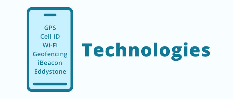
As mentioned before, there are several technologies for determining the user’s geo-position in the location-based app. They are divided into external and internal geo detecting services. What is the difference? Let’s see.
Outdoor geolocation technologies
Outdoor navigation technologies allow for identifying the user’s location while making routes and destinations in the open air. It’s based on GPS signals, cell phones and satellite imagery.
GPS – the most popular and accurate way of determining location. GPS receives satellite signals, calculates the position within 15 meters, and works almost anywhere without the Internet. But it has one disadvantage – significant use can rapidly deplete the device’s battery.
Cell ID – When a GPS signal is unavailable, a cell ID can determine coordinates through cell towers. But this solution isn’t as precise as GPS, and only offers a trusted result when in megalopolises with a large number of base transceiver stations.
Wi-Fi positioning –This is a reasonably accurate way of locating someone (up to 25-50 meters). It doesn’t deplete batteries as quickly as GPS, but it does require an established connection to Wi-Fi.
A-GPS (Assisted GPS Service) – This technology combines all previous outdoor geolocation technologies' capabilities into one powerful way of identifying coordinates. It receives data from servers and satellites, then transmits it through the Internet via Wi-Fi or cellular communication. But A-GPS has a few flaws: certain functions can only work with a cellular network. If the signal is lost, the necessary re-synchronization can increase costs, especially when roaming. However, this technology has a powerful potential for geolocation-based apps.
Indoor geolocation technologies
When we aren’t in the open air, we need indoor geolocation technologies for precise location and navigation. Indoor technologies allow Amazon’s virtual assistant, Alexa, to turn off the lights when you leave home. It’s all about IoT.
Let’s look at a few popular ways to determine indoor geolocation.
Geofencing – This technology works by combining cell data with Wi-Fi and GPS data. It has no precision for your own geolocating but is helpful when you need to start a pre-programmed action in a certain mobile network range like with Alexa.
iBeacon и Eddystone – Both of these technologies work the same by using BLE (Bluetooth Low Energy) for internal positioning. iBeacon was made by Apple for iOS devices and Eddystone by Google for Android-products. Special apps receive ID signals from beacons when devices are within their radius, triggering a specific action. For example, when you walk through a museum using a special mobile app, you will see a description of the nearest installations displayed on a screen.
Wondering how to build
an exclusive software product for your business?
CONTACT USBased steps of location-based app development

Let’s discuss what it takes to create a location-based app. We’ve already mastered the basic functionality and technology, but it’s time to consider the main development steps that are important for the product's future.

First of all, we are creating an app, so it will begin with the same components as every other mobile product. These include:
- user interface – the part of the app in which customers interact
- business logic – this is everything made for product functionality but hidden from the customer’s eyes;
- secure database – the place to save all information
We have several specific functions for geolocation applications, which distinguishes them from most others:
- integrated maps
- determination location
- GPS coordinates
- route construction
Product specificity, purpose, and category determine additional features based on geolocation. For example:
- possibility of radius setting
- adding ratings and recommendations
- ability to share a location with friends
- real-time information updating (showing traffic jams and excessive traffic)
- compounding a map with the weather forecast
One of the most useful features – push-notifications – can be added to your geolocation app and are sent depending on where the user is located.
Experts from the mobile app development company, Owlab, always recommend their customers begin with an MVP, the product’s basic version, which only includes vital functions. This approach allows them to create a prototype of the future app by testing the idea with minimal investment. You’ll see what users truly need, what to change, and what to remove or add without wasting years and thousands of dollars.
Creating an MVP is a low-risk strategy to test your concept.
Step 2. Work out the tech side

The technology stack is defined by the platform for which the application is being developed (iOS / Android / Web), as well as its business goals. You need two APIs to create a mobile geolocation product: determining the user’s location and placing this information on a map. The use of APIs speed up the development process and reduce budgets by eliminating the need to write individual tools from scratch.
iOS geolocation
iOS devices can search both Google Maps and Apple API to display a location — Google Maps SDK or Apple MapKit. Both services have a decent level of accuracy, but several differences may affect the final choice:
- Data display quality – Google wins this “contest.” But Apple follows closely by adopting advanced technologies. This year, they presented a new map of the United States, revealing the greatest environmental detail and a 3D image of major cities. Apple also plans a renewal for Europe later this year.
- Routing – Google provides only one route for walking, cycling, taxi, and public transport, while Apple MapKit offers several options. Feature AR is available only in Google Maps.
- Indoor maps – Google’s indoor navigation is available to 10,000 buildings around the world, approximately, while Apple still offers detailed-only maps for airports and major shopping malls.
- Offline maps – available only in Google Maps.
- Privacy – an advantage of Apple MapKit. The system doesn’t gather search history but adds random identifiers to data. The user's device stores most navigation information.
- Cost – Apple MapKit is free and does not limit the count of API requests per day. Google obtains a “pay as you use” option and has restrictions for downloading cards.
In summary, Google remains the best mapping service for geolocation mobile apps. Exceptions include products that require access to target locations, such as the US and China, as well as a large number of API accesses.
Android geolocation
Concerning Android devices, there are also two locating options – android. location package and API Google Location Services. The latter one is simpler, more accurate, and energy-efficient. The display can be created by:
- Google Maps API and MapView class.
- Google Maps Directions API to create and plan routes.
- Google Distance Matrix API to calculate the travel time.
HTML5 geolocation for progressive web apps
There are several services for creating web apps or geolocation PWA:
- W3C Geolocation API – works only through https, but supported by most browsers.
- HTML5 geolocation API – an important support feature to have in your browser, but has a lower performance than the previous solution.
- Google Maps API.
- MapKit JS by Apple.
The chosen solution depends on the future product’s features, required functionalities, and the application’s opportunities. Owlab experts have adequate experience and market knowledge to offer you optimal tools for creating iOS, Android, or progressive web apps to achieve your business goals.
Wondering how to build
an exclusive software product for your business?
CONTACT USStep 3. Create a design and user interface

We often discuss the importance of UI/UX design for mobile products. Geolocation mobile apps must have a simple, understandable, and attractive interface as well. This is where the user's connection begins with your product and, unfortunately, often ends with it, destroying the developer's work and your budget. The intuitive design is crucial for a location-based app. All functions should be obvious and available in one click.
Step 4. Deal with security matters

From the moment you decide to create a location-based application, security should be your priority. Privacy issues are the main reason users disable geolocations or don’t allow mobile products to access them. And no wonder, since the tool identifies locations and processes user information that not everyone is ready to reveal.
To avoid this issue and retain your target audience, it is important to ensure full transparency of collected data. Users need to understand how and for what reason you’ll collect the data and how you will protect it.
Let’s consider specific actions which are significant for creating a location-based app:
- Request user permission to determine the location. Offer a choice: to confirm geolocation each time or to include features permanently. It is important to let users choose if they want to select or disable any tracking option.
- You should ensure the appropriate confidentiality of data and communicate it to your target audience, which is critical for building product confidence. You must protect geodata by encrypting communications, introducing multi-factor authorization and advanced security technologies, installing an SSL certificate, and more. Use network security settings for Android apps or App Transport Security for iOS.
- Explain why you need location data and how you intend to use it. It is beneficial to describe how you store user data if this information is available to third parties, why and under what conditions, and how users can manage their data. These steps will ensure transparency in the relationship and explain why it is essential to provide geolocation access.
-
Evaluate third-party components. Libraries and frameworks optimize the mobile app development process, but not all have sufficient security measures. Remember, their vulnerability becomes your responsibility.
- Ensure the app complies with GDPR (for EU) and other countries in which you plan to work.
By preventing potential issues at the beginning, you can avoid facing the consequences of an unsafe product later on. Owlab creates mobile apps that consider all specified and user data protection factors. Our partners receive reliable smartphone products designed for long-term use.

Now that the main technical points have been discussed let’s talk about concrete figures. Developing a mobile geolocation app depends on the location in which you are looking for developers. Work from Western Europe or the United States will cost far more than from Ukraine and offer the same end-product quality. Working with developers from India will yield the lowest price, but also the lowest quality.
Let’s have a look at the specifics:
- USA – 1 hour of development = $100-150 or more, cost of an app begins at $10 000.
- Western Europe – 1 hour of development = € 80-150, cost of an app begins at $18 000.
- Eastern Europe – 1 hour of development = $20-70, cost of an app begins at $5 000.
- Ukraine – 1 hour of development = $30-50, cost of an app begins at $5 000.
- India – 1 hour of development = $10-30, cost of an app begins at $5 000.
Adding a geolocation function to your mobile app can improve your marketing strategy, ensure the accuracy of customer interactions and offer various advantages over competitors. However, only with a qualified development team, can a good idea become a viable product.
By choosing the mobile app development company, Owlab, you can gain a reliable partner for your business. We can help you create your own app with secure geolocation and fast time-to-market.
Contact us to discuss your great ideas, and start a new project today!